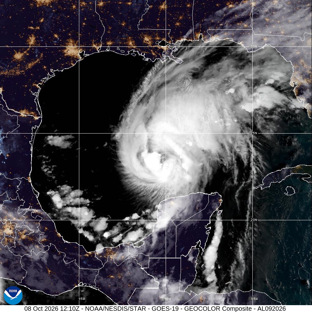

Updated October 8, 2026: Hurricane Isaias strengthened to 85 mph (140 km/h) by the National Hurricane Center’s 10 a.m. Central Daylight Time advisory. Residents along the northern Gulf Coast are being warned about dangerous storm surge, damaging winds and heavy rainfall. This report uses a time-stamped forecast; readers should check official advisories for subsequent changes.
Where is Hurricane Isaias now?
At 10 a.m. CDT on Thursday, the center was near 23.7°N, 90.2°W, about 380 miles south of the mouth of the Mississippi River. The storm was moving east-northeast at 10 mph with maximum sustained winds of 85 mph. The NHC forecast landfall somewhere within the northern Gulf Coast warning area late Friday or early Saturday. A precise landfall point was not certain.
Storm surge and hurricane warnings
A storm surge warning extended from the mouth of the Mississippi River to the Suwannee River, Florida. A hurricane warning covered Ocean Springs, Mississippi, to the Bay/Gulf County line in Florida. The NHC forecast potential peak surge of 5–7 feet in some areas between Ocean Springs and Indian Pass, including Mobile Bay, if peak surge coincided with high tide. Local conditions will vary.
Rainfall, flooding and tornado risks
Forecast rainfall of 3–7 inches was possible across the central Gulf Coast, with localized totals as high as 15 inches, especially in parts of the Florida Panhandle and Big Bend. Flash flooding, river flooding and isolated tornadoes were also possible. Residents should not drive through flooded roads and should follow evacuation instructions from local officials.
What happens next?
The NHC expected further strengthening into early Friday. Coastal residents should prepare for possible power interruptions and transportation disruption. The forecast is not a guarantee that every warned location will experience the same conditions.
For related international public-health coverage, read our report on the WHO’s questions about a laboratory worker’s death in Russia.
Official sources and latest forecast
For the most recent warnings, consult the National Hurricane Center and National Weather Service. This article draws on NHC Public Advisory No. 8, issued October 8 at 10 a.m. CDT.
Discover more from NewsNation Online
Subscribe to get the latest posts sent to your email.
आपके लिए सुझाव













Leave a Reply