Kathmandu, October 2, 2026: Nepal is preparing a six-year effort to lower the water levels of four dangerous high-altitude glacial lakes, a major climate-adaptation project announced after catastrophic flooding in the Himalayan border region with China killed more than 1,400 people and left thousands missing.
The project targets Thulagi, Lower Barun, Lumding Tsho and Hongu II, lakes perched between roughly 4,050 and 5,483 metres above sea level. Reuters reported that work is due to begin in the current fiscal year, with officials planning controlled drainage systems, monitoring equipment and stronger early-warning arrangements for communities downstream.
Why Nepal is moving now
The urgency follows the devastating August disaster near the China-Nepal border. A glacier collapse unleashed rock, ice, mud and water through mountain valleys, destroying infrastructure and communities. Rescue and recovery efforts continued for weeks as authorities also confronted the possibility of additional unstable lakes forming upstream.
That disaster highlighted a danger that Himalayan scientists have warned about for years: as glaciers retreat, meltwater can collect behind natural dams made of loose rock, ice and sediment. These glacial lakes can grow rapidly. If the dam fails because of an avalanche, earthquake, ice collapse or rising water pressure, a sudden glacial lake outburst flood can rush downstream with enormous destructive force.
How the four-lake drainage project will work
Nepal does not intend simply to empty the lakes. Engineers plan to lower water levels in a controlled way by building gated drainage structures and channels that release water toward nearby rivers. Lowering the lake surface can reduce pressure on unstable natural dams and create additional capacity to absorb future meltwater.
The program is expected to cost about $50 million and run for six years. Reuters reported that financing will come from the Green Climate Fund, the United Nations Development Programme and Nepal’s government. The physical engineering work will be accompanied by sensors, flood forecasting and community-preparedness systems designed to provide warning if conditions deteriorate.
Working above 5,000 metres creates unusual engineering challenges
Projects at Himalayan altitudes face difficulties that conventional civil engineering rarely encounters. Roads may not reach the work sites. Heavy machinery, fuel, construction material and monitoring equipment can be difficult to transport. Workers must operate in thin air, rapidly changing weather and terrain exposed to avalanches and landslides.
The lakes themselves can also change while work is underway. Glaciers continue to melt, slopes remain unstable and earthquakes can alter drainage systems. That means engineers need continuous monitoring rather than treating drainage as a one-time intervention.
Nepal has lowered dangerous lakes before
The country has previous experience with this type of climate adaptation. Water levels at Tsho Rolpa and Imja Tsho have been lowered in earlier projects to reduce the risk of sudden floods. Those interventions provide valuable engineering lessons for the new program, although every lake has different geography and hazards.
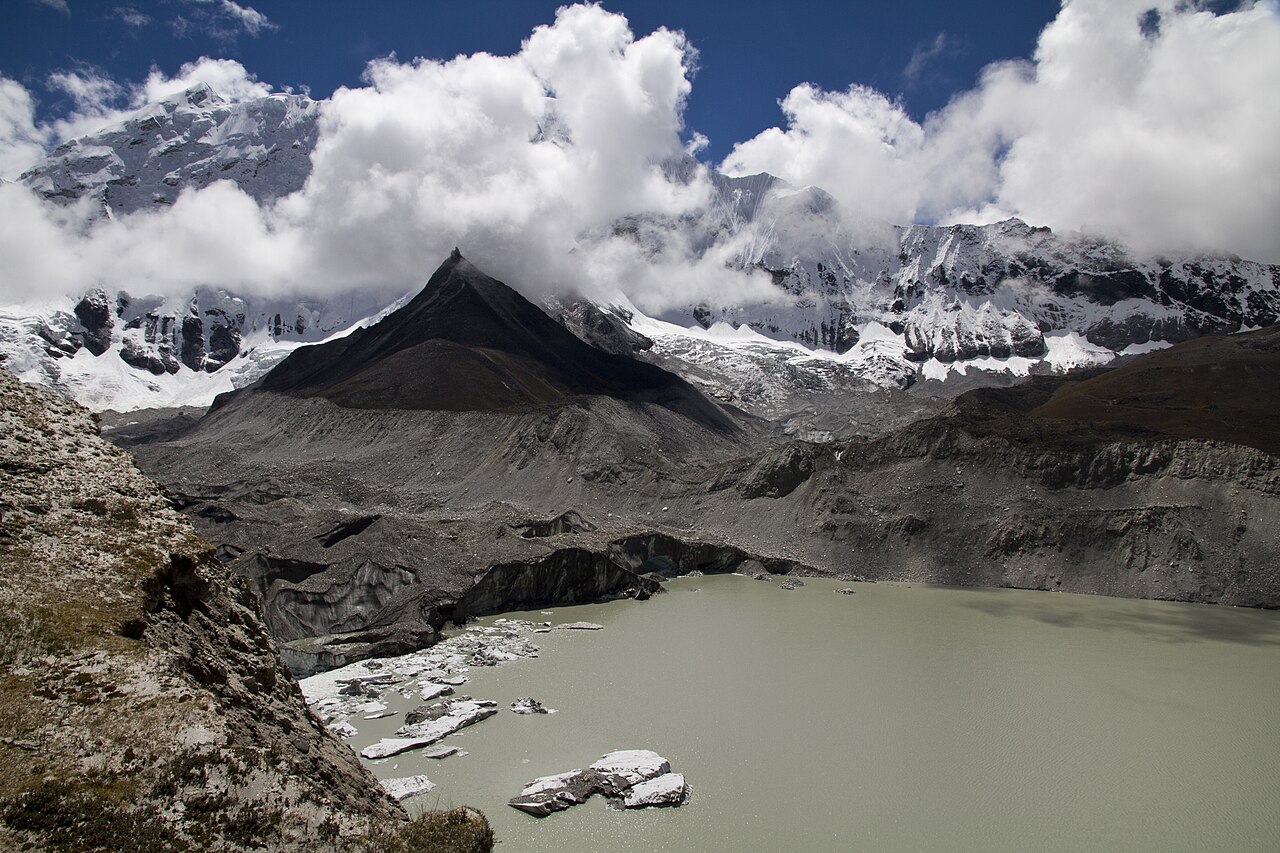
Imja Tsho, in Nepal’s Everest region, is one of the best-known examples of a lake that expanded as surrounding glaciers retreated. The featured image accompanying this NewsNationOnline report shows Imja Lake and Glacier in 2011, illustrating how meltwater can accumulate in moraine-dammed basins high in the Himalayas.
Climate change is increasing Himalayan risk
The Himalayas are sometimes described as Earth’s “third pole” because of the vast amount of ice stored across the mountain system. Rising temperatures are altering that frozen landscape. Retreating glaciers can initially increase meltwater and expand lakes; over longer periods, ice loss also threatens water supplies for communities and river systems that depend on seasonal snow and glacier melt.
A warmer atmosphere does not make every individual flood attributable to climate change in exactly the same way. Local geology, earthquakes, avalanches and extreme rainfall can all contribute. But sustained glacier retreat increases the number and size of high-altitude lakes capable of becoming flood hazards, creating a growing adaptation challenge for mountain countries.
Early warnings may be as important as engineering
Lowering a lake can reduce risk, but it cannot eliminate every hazard. That is why the Nepal project includes sensors and forecasting. Monitoring water levels, glacier movement, rainfall and upstream conditions can give authorities precious time to alert settlements, hydropower facilities, roads and bridges downstream.
Data sharing across borders is also important. After the August catastrophe, Nepal renewed calls for more upstream information from China because Himalayan river systems do not stop at national boundaries. Reuters previously reported that Nepali officials wanted more information on glacier risks and water levels to improve preparedness.
The economic stakes extend far beyond mountain villages
Glacial lake outburst floods can damage highways, bridges, farms, tourism routes and hydropower projects. Nepal relies heavily on hydropower and mountain tourism, meaning a disaster in a remote valley can produce national economic consequences. Rebuilding transport links in steep terrain is expensive and can isolate communities for long periods.
Prevention therefore has an economic case as well as a humanitarian one. A $50 million risk-reduction program can appear expensive, but a single uncontrolled flood can destroy infrastructure worth far more while causing loss of life that cannot be replaced.
Why this project matters beyond Nepal
Other mountain regions face similar problems, from the wider Himalayas to the Andes. As glaciers retreat, governments must decide which lakes pose the greatest danger, how to monitor them and when physical intervention is justified. Nepal’s new project will therefore be watched as a real-world test of large-scale adaptation in some of the world’s most difficult terrain.
The lesson is increasingly clear: climate adaptation is not only about long-term planning. In high mountain regions, it can mean moving water, building warning systems and preparing communities before a natural dam fails. Nepal’s decision to tackle four lakes simultaneously shows how quickly that challenge is growing.
What happens next?
Officials expect the six-year program to begin during Nepal’s current fiscal year. Detailed engineering work, access arrangements and monitoring will determine the pace at individual lakes. Because the sites are remote and conditions can change rapidly, the project will require sustained technical and financial support rather than a single construction season.
For communities living below the glaciers, success will ultimately be measured by something difficult to see: disasters that do not happen. Controlled drainage, reliable sensors and faster warnings cannot stop glaciers from retreating, but they can reduce the chance that another expanding lake becomes the source of a deadly surprise.
Sources and image credit
This report is based on Reuters reporting published October 2 and earlier Reuters coverage of the August Himalayan flood and cross-border warning challenges. Featured image: Imja Lake and Glacier, Nepal, photographed by Daniel Alton Byers via Wikimedia Commons, licensed CC BY-SA 3.0.
आपके लिए सुझाव
